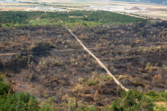
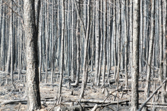
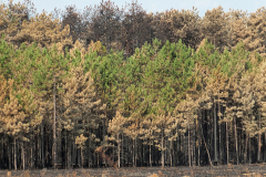
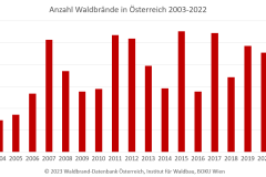
Around 200 forest fires occur in Austria every year, most of which are caused directly or indirectly by humans. In suitable weather conditions and in critical locations, large-scale fires can also occur. For example, a large-scale forest fire in the Rax-Schneeberg area in 2021 triggered considerable media coverage. Forest fires can endanger people, infrastructure, and settlement areas and cause extensive damage and high costs. Information on forest fires and the forest fire risk in Austria can be obtained from the forest fire blog (LINK: https://fireblog.boku.ac.at), which is run by the Institute of Silviculture at BOKU Vienna (LINK: https://boku.ac.at/wabo/waldbau). Current forest fire occurrences can be followed in the Austrian forest fire database (LINK: https://fire.boku.ac.at). It is also possible to call up statistics and graphics here. In 2022, the Institute of Silviculture, in cooperation with BML and BFW, has produced forest fire hazard maps at the community level (LINK: https://www.schutzwald.at/service/news/schutzwald/2022/risikokarte-gemeindeebene.html) based on meteorology, socioeconomics, vegetation and exposure.
In a current project of the Institute of Silviculture with the Rocket NG GmbH, it is planned to collect in real-time and online the litter moisture (moisture of the uppermost soil horizon), air temperature, and humidity in selected forest sites. The data collected in this way are important metrics for assessing forest fire risk more accurately, locally, and thanks to the online availability of the information, in real-time. The Rocket NG IoT platform supports hazard detection through automated monitoring of threshold values.
The self-sufficient node of Rocket NG is ideal for measurements in remote regions without fixed power connection. The determination of scattered moisture via so-called fuel sticks was newly implemented for this project. The implementation has now been successfully completed and the test phase of the sensor technology is underway. The first measurements in different forest communities are to start in March. The entire development time up to the measurements in the forest took less than 3 months!
The monitoring system is easy to use, requires no configuration, and is immediately ready for operation. The installation is easy and done by the Institute of Silviculture itself. We are excited to see how the newly acquired data can improve the assessment of local forest fire risk and will keep you informed.
pictures: M. Müller
You can find more information on the following pages:
Austrian forest fire database:
https://fire.boku.ac.at
Integrated Forest Fire Risk Assessment System: https://www.waldbrand.at
Forest Fire Action Programme of the BML: https://info.bml.gv.at/service/publikationen/wald/brennpunkt-wald-aktionsprogramm-waldbrand.html
White Paper on Forest Fire, adapted for Austrian conditions: https://www.alpine-region.eu/sites/default/files/uploads/result/2233/attachments/200717_waldbraendealpen_weissbuch_final_online_austria.pdf
Forest Fire Blog Austria:
fireblog.boku.ac.at
Institute of Silviculture of BOKU Vienna:
boku.ac.at/wabo/waldbau


